How Ecological Maps Can Make Cities More Livable
Ecological data is helping urban planners understand and protect biodiversity and make cities habitable for both wildlife and humans
In Chengdu, a city of more than 20 million people, Eurasian otters have quietly returned to the rivers. A first sighting in the urban centre, after decades of absence, prompted coordinated monitoring with public input across the river system.
Their return is significant because otters are sensitive ecological indicators: where they thrive, the broader river system tends to be healthy. This also raises a broader issue: without proper monitoring and tracking, many important ecological changes can easily go unnoticed.
Step outside in any city and you'll notice the obvious: traffic, buildings, people on the go. Less obvious is nature's rhythm — birds stopping in a park en route to another region, insects moving through grass, shade from trees providing relief from the heat.
These living systems help make cities habitable. But growing urbanization places greater pressure on them. The challenge is how to better understand and protect the systems supporting urban nature.
Ecological maps are one practical response.
A city-wide picture, built from the ground up
The idea came to Tencent when rolling out a program to prevent birds colliding with glass. Employees started patrolling buildings, applying protective film, and logging what they found. Simple record-keeping grew into a digital tool, then a citizen science platform, and ultimately a method for building a living map of urban biodiversity.
Through the Wild Friend Mini Program available on Weixin, people can photograph and log species encountered in daily life — a rose photographed from a balcony, a bee spotted on the way to work, a butterfly in a park, even otters appearing on a river bank. Once verified by experts, these observations are layered with scientific baseline data to produce heat maps and species distribution maps urban planners can use.
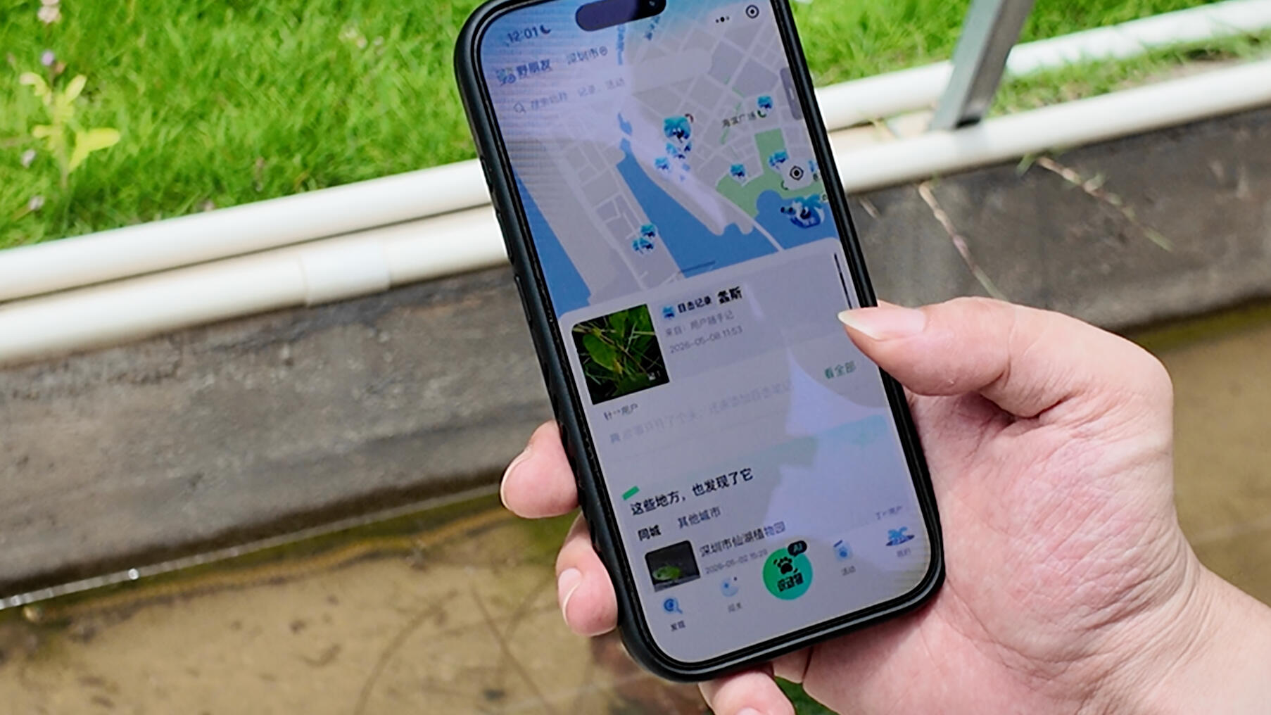 Users can contribute to the ecological map through Wild Friend Mini Program.
Think of it as a city-wide jigsaw. Each sighting contributes one piece. Enough pieces, and a pattern starts to emerge.
"We hope that every person's phone camera can help fill data blind spots in biodiversity monitoring," says a Tencent representative.
As of May 2026, people have contributed more than 210,000 nature observations from across China. Among the insect records, users even helped identify a species never before documented in the country.
Citizen science: contributing to biodiversity data collection
In Shenzhen, a 14-day citizen science survey brought together more than 1,000 participants and generated over 42,000 ecological records — a near real-time picture of biodiversity across the city. Rare and protected species were recorded. Early life stages of species previously undocumented in China were recorded for the first time through citizen photographs.
"Public observations can often capture things that are difficult to collect as physical specimens," noted one expert involved in the project. The goal is continuous, crowd-sourced data collection to complement formal surveys, not replace them.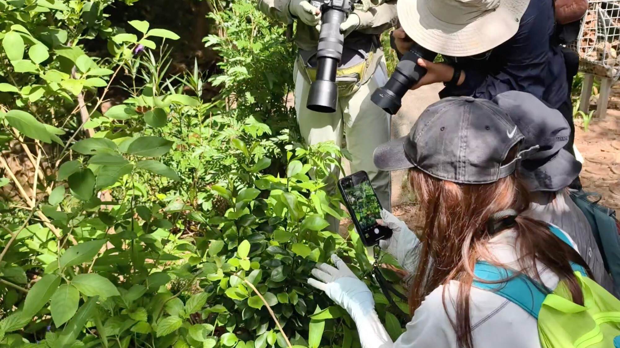 Participants document urban biodiversity during Shenzhen’s city-wide citizen science survey.
The real value of an ecological map is in what it enables. When cities can see where animals rest and where habitats are connected, they can act more precisely — planting native vegetation to reconnect green spaces, or identifying parks that could be slightly modified to support wildlife movement across neighborhoods.
An ecological map is never finished. It grows incrementally, through many small contributions — which makes the model scalable.